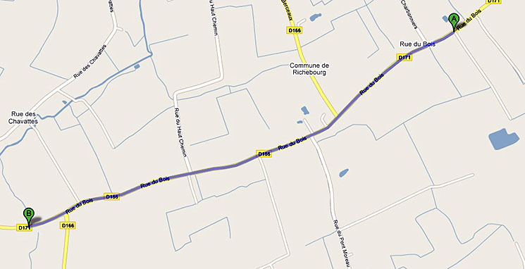
The Last Absolution Location Map.
|
|
|||
|
From the Cinder Track to the Last Absolution site is approximately 2.6 km. The site is on the left-hand side of Rue du Bois. |
|||
|
|
|||
|
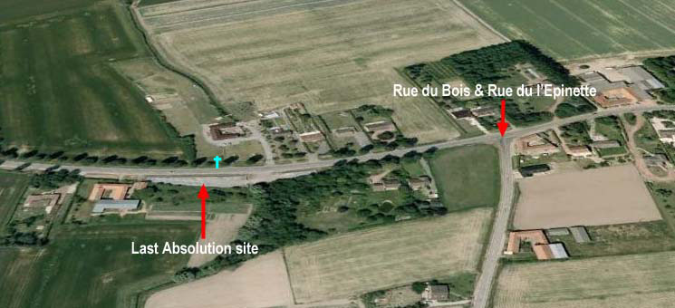
Google Earth view of the Last Absolution site. The road realignment is clearly shown and the old road section has been bounded by a stone wall with an entrance at right end. The cross on opposite side of road indicates the approximate position of the Chapel Notre Dame de Seez built in 1929 in replacement of the original destroyed during World War One. |
|||
|
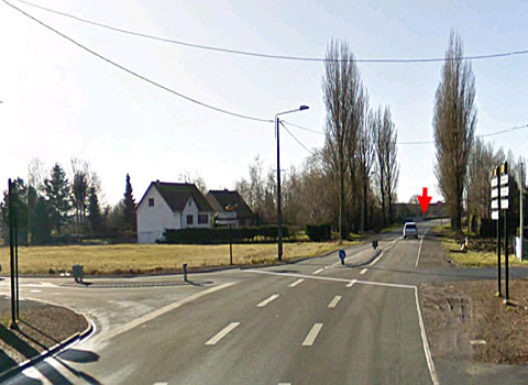
I'Epinette & Driving from the Cinder Track along Rue du Bois, approximately km. watch for the junction of Rue de I'Epinette with Rue du Bois, the Last Absolution site is 0.5 km. further along on the left-hand side. |
|||
|
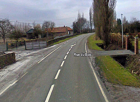
Last Absolution Site. The stone walls on left enclosing the old road section. The site of the Last Absolution. Rue du Bois was realigned in the 1970's. The Chapel Notre Dame de Seez was situated on the opposite side to the stone walls. Land resumption for the road realignment resulted in the chapel being demolished.
|
|||
|
Credits: Map 1 Google
Maps. |
|
||