Nueve Chapelle Nord-Pas de Calais Region
|
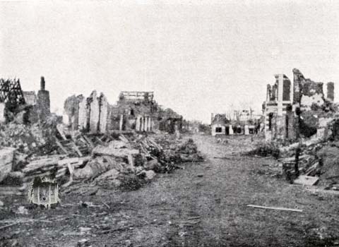
Neuve Chapelle immediately after it's capture on 10 March 1915. Nueve Chapelle is situated in the Nord-Pas de Calais region of France and has always been one of the most strategic and hence one of the most fought-over regions of France. In the First World War much of the region was occupied by Germany and many of its towns and hundreds of square miles of land were wrecked in four years of trench warfare, with the region suffering more damage than any other part of France. |
|||
|
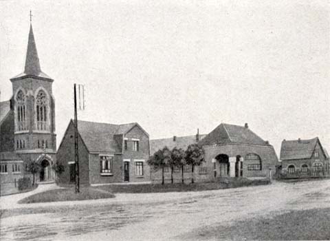
Post WW1 Rebuild
Germany occupied Nueve Chapelle again in the Second World War and used the region as a launching base for attacks on England by the Luftwaffe. Heavy Allied bombing and fighting on the ground again devastated many of the region's towns. |
|||
|
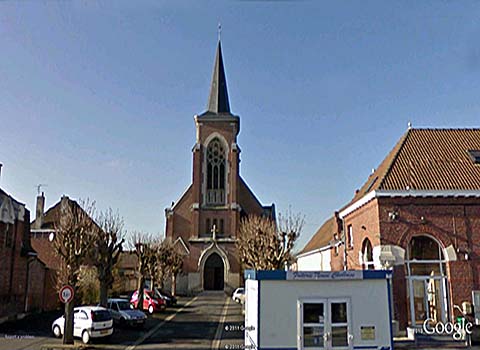
Neuve Chapelle Post WW2. This street view from Google Earth shows the rebuilt church (post WW2) with a slightly different entrance arch, on corner of Rue du Bois and Rue du Moulin. Turning left in Rue du Moulin and approximately 0.64 km. along on the right hand side is a track that leads to an isolated cemetery
|
|||
|
Credits: Top Western Front Then and
Now. C. Arthur Pearson Ltd. London published 1938. |
|
||


